

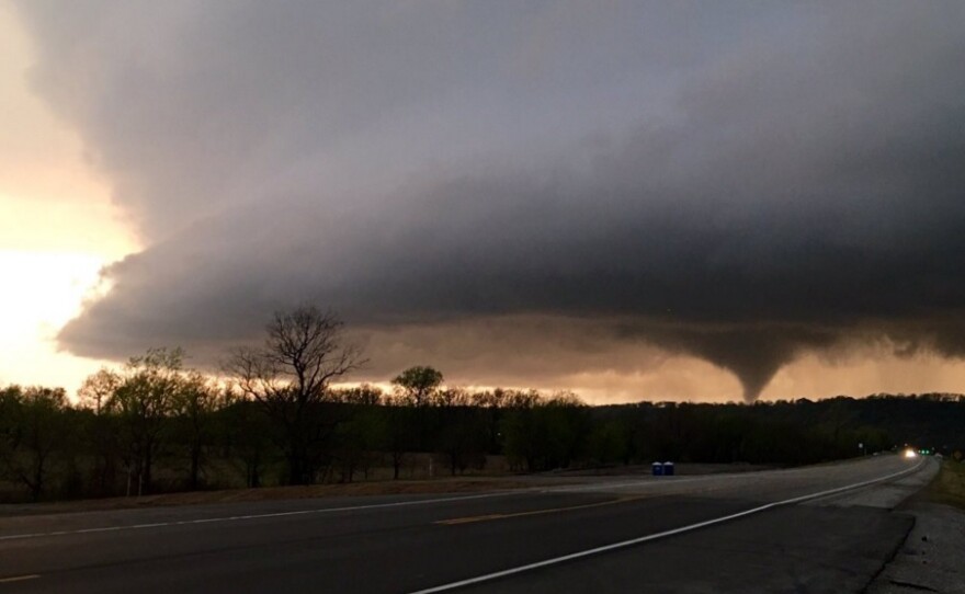
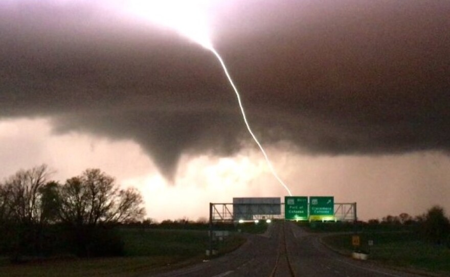
At least seven people were injured in severe storms in northeast Oklahoma Wednesday afternoon and evening. National Weather Service meteorologist Amy Jankowski told The Associated Press a tornado touched down and lifted up numerous times as it swept through the northern Tulsa and Owasso areas.
Updated March 31, 7:04 a.m.
Emergency Medical Services Authority spokeswoman Kelli Bruer says the ambulance service transported seven patients in Tulsa. One was in critical condition and several were in serious condition.
“All of the injuries were on 45th Street North to 47th Street North,” Bruer said.
Tulsa mayor Dewey Bartlett says the twister cut a lengthy path through that area between Martin Luther King, Jr. Blvd. and Harvard Ave.
"And from that point the tornado then went into a very rural area,” Bartlett said. “It went between areas where there were significant neighborhoods."
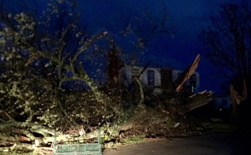
Tulsa Fire Department spokesman Stan May says about one square mile of a mostly residential area sustained damage. He says one home was destroyed. There were no immediate reports of anyone missing.
RAW VIDEO: Watch Wednesday's tornado form and touch down https://t.co/8aMEUgcUL3 pic.twitter.com/SoLLRZvW5V
— Tulsa World (@tulsaworld) March 31, 2016
Homes were also damaged in nearby Owasso. Emergency responders rushed to the aid of those living in the Stone Canyon addition. The tornado crossed Highway 169 and headed straight for the upscale housing addition.
"I observed the storm from the highway,” said resident Matt Ross. “I saw the mesocloud and I saw the funnel cloud. It was pretty impressive."
Meteorologists from the National Weather Service will begin their assessment of the tornado Thursday.
Updated 1:40 p.m.
18UTC balloon launch from @NWSNorman is underway... #OKwx pic.twitter.com/02nvh3RBAz
— Kevin Kloesel (@texasembassy) March 30, 2016
The National Weather Service's Norman Forecast Office launched a radiosonde attached to a weather balloon Wednesday afternoon. Here's what they found:
- Surface-level and upper level winds don't support a significant tornado threat. It's not zero, but it's very low.
- Temperature changes in the middle parts of the atmosphere could contribute to large hail within any storms that do form.
- Storms will likely form because there's very little cap in place.
What's "cap," you might ask? According to this glossary of weather terms from the NWS, a cap is a layer of warm air several thousand feet above the ground, which keeps thunderstorms from forming:
The cap is an important ingredient in most severe thunderstorm episodes, as it serves to separate warm, moist air below and cooler, drier air above. With the cap in place, air below it can continue to warm and/or moisten, thus increasing the amount of potential instability. Or, air above it can cool, which also increases potential instability. But without a cap, either process (warming/moistening at low levels or cooling aloft) results in a faster release of available instability - often before instability levels become large enough to support severe weather development.
Original Post:
After a few showers moved through central and southern Oklahoma in the morning, another round of storms could fire after 2 p.m. Large and damaging hail, up to the size of tennis balls, are the primary threats, but there is a potential for tornados.
Some important reminders about severe weather forecasts and outlooks - #okwx #texomawx pic.twitter.com/BQz9E5KkPV
— NWS Norman (@NWSNorman) March 30, 2016
“We’re not certain to see tornados, but we do need to be on guard that we could see, with the most intense thunderstorms, there could be a tornado or two this afternoon,” Norman Forecast Office Warning Coordination Meteorologist Rick Smith said in a 9:45 a.m. severe weather briefing.
The best chance comes south of Interstate 40 and east of Interstate 35, although storms could start to fire west of the metro along the dryline as early as 3 p.m.
“[It] basically runs along Highway 81 from Enid to Kingfisher, then down to Lawton and Wichita Falls,” Smith said. “Areas along and east of that line will have the highest potential to see thunderstorms this afternoon as a dryline pushes into central Oklahoma.”
@thejonkc not marked, but this map will show where dry air is. Lower number = drier air. Updated every 5 minutes https://t.co/JQ4KVXzEDX
— NWS Norman (@NWSNorman) March 30, 2016
That dryline is living up to its name. On the other side, in far western Oklahoma, there’s a critical wildfire threat due to strong winds, low humidity, and warm temperatures. A Red Flag Warning goes into effect at 1 p.m.

Information from the Associated Press was used in this report.
KGOU is a community-supported news organization and relies on contributions from readers and listeners to fulfill its mission of public service to Oklahoma and beyond. Donate online, or by contacting our Membership department.


