


Updated 2:19 p.m.
The National Weather Service has issued a Severe Thunderstorm Watch for much of central and eastern Oklahoma as the threat of severe weather slowly increases.
The Norman Forecast Office says the prime time for storm development should come between 3 and 5 p.m. Wednesday.
Again, damaging hail and strong winds are the main concerns. The tornado threat is very low, but it is not zero. Stay alert! #okwx #texomawx
— NWS Norman (@NWSNorman) March 25, 2015
Updated 12:12 p.m.
Oklahoma could see its first bout of severe weather Wednesday.
The 2015 storm season also comes after a mild 2014 with an uncharacteristically low number of significant tornado outbreaks.
The National Weather Service says there's an increasing chance for strong thunderstorms across central and southeastern Oklahoma Wednesday afternoon and evening.
Norman Forecast Office meteorologist Bruce Thoren says 60-to-70 mile-per-hour damaging straight line winds are possible. The Storm Prediction Center indicates there’s a moderate risk for golf-to-tennis ball-sized hail northeast of the metro.
Not a tornado outbreak today, more like a hail outbreak. Even as @NWSSPC risk goes up. Tornado risk stays very low. #okwx
— Brad Sowder (@TheBradSowder) March 25, 2015
“Initially storms may develop near the Oklahoma City area, primarily after 3 or 4 o’clock in the afternoon,” Thoren said. “Then by the mid-to-late evening, most of the severe weather will be confined to southeast of the Holdenville, Ada, and Ardmore line.”
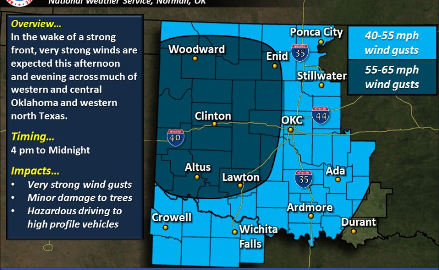
A Wind Advisory goes into effect at 4 p.m. Wednesday for Northwest Oklahoma, and 7 p.m. in the metro. Both last until 4 a.m. Thursday.
The Tulsa area and western Arkansas could see an isolated tornado late this afternoon and early evening.
Timing of today's severe weather threats. Keep up with the latest forecasts today! #okwx #arwx pic.twitter.com/ZWWyJH0Q0a
— NWS Tulsa (@NWStulsa) March 25, 2015
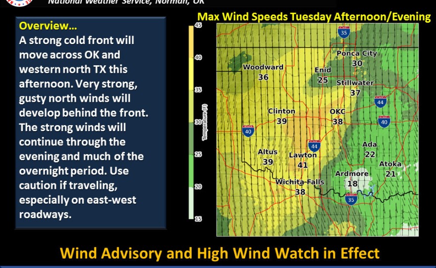
In northwest Oklahoma behind the cold front and dryline there's an elevated concern for wildfires due to a wind shift. Those gusting north winds could make travel a little difficult, especially along an East-West axis.
Highs will be in the lower 80s Wednesday afternoon in central Oklahoma, and about 10 degrees cooler in the northwest.
------------------------------------------------
KGOU relies on voluntary contributions from readers and listeners to further its mission of public service to Oklahoma and beyond. To contribute to our efforts, make your donation online, or contact our Membership department.


